Parent Directory
| Start time | End time | Last Latitude & Longitude | Current (1hr avg) |
|---|---|---|---|
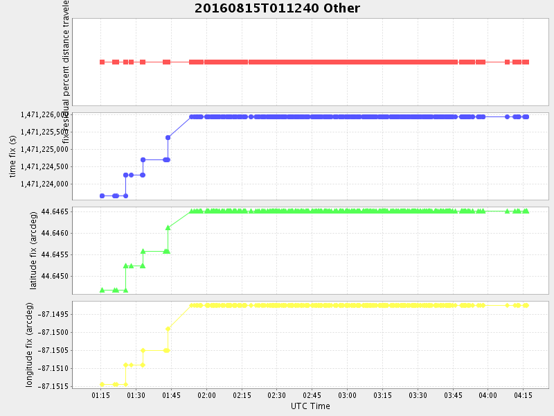
| 2016/08/15 01:12:07 GMT 2016/08/14 18:12:07 local | 2016/08/15 04:16:31 GMT 2016/08/14 21:16:31 local | 44.644499223661974 -87.15351274936705 | 3.2951975808638623 Amp |
| Downloads: | ||||
| shore.nc shore.mat |
shore.kml shore.kmz |
shore.asc shore.dir |
shore.csv shore.log |
argos_24hr.kml argos_week.kml, argos_month.kml |
| Elapsed time since start: ... | Elapsed time since last valid data: ... |