Parent Directory
Parent Directory
Parent Directory
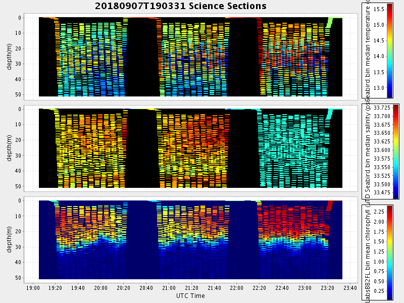
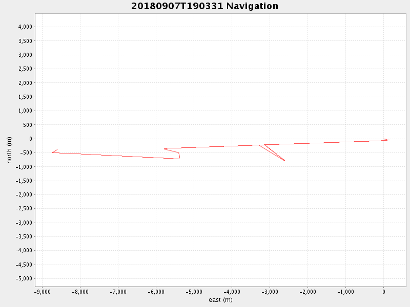
| Start time | End time | Last Latitude & Longitude |
Current (1hr avg) |
|---|---|---|---|
| 2018/09/07 19:03:44 GMT 2018/09/07 12:03:44 local |
2018/09/07 23:33:27 GMT 2018/09/07 16:33:27 local |
36.984302808505554 -122.51867963846038 |
1.3839321555448816 Amp |
| Downloads: | ||||
| shore.nc shore.mat |
shore.kml shore.kmz |
shore.asc shore.dir |
shore.csv shore.log |
argos_24hr.kml argos_week.kml, argos_month.kml |
| Elapsed time since start: ... | Elapsed time since last valid data: ... |