Parent Directory
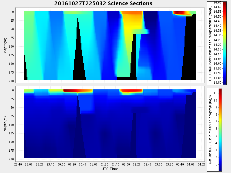
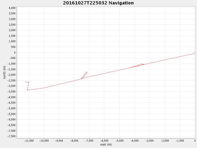
| Start time | End time | Last Latitude & Longitude | Current (1hr avg) |
|---|---|---|---|
| 2016/10/27 22:50:59 GMT 2016/10/27 15:50:59 local | 2016/10/28 04:10:03 GMT 2016/10/27 21:10:03 local | 36.754149666390326 -122.03996333221043 | 2.5893772649229576 Amp |
| Downloads: | ||||
| shore.nc shore.mat |
shore.kml shore.kmz |
shore.asc shore.dir |
shore.csv shore.log |
argos_24hr.kml argos_week.kml, argos_month.kml |
| Elapsed time since start: ... | Elapsed time since last valid data: ... |