Parent Directory
| Start time | End time | Last Latitude & Longitude | Current (1hr avg) |
|---|---|---|---|
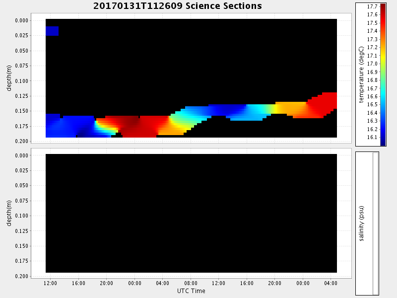
| 2017/01/31 11:26:27 GMT 2017/01/31 03:26:27 local | 2017/02/02 04:56:29 GMT 2017/02/01 20:56:29 local | 36.802827833049925 -121.78774266555807 | 0.016403312691767178 Amp |
| Downloads: | ||||
| shore.nc shore.mat |
shore.kml shore.kmz |
shore.asc shore.dir |
shore.csv shore.log |
argos_24hr.kml argos_week.kml, argos_month.kml |
| Elapsed time since start: ... | Elapsed time since last valid data: ... |