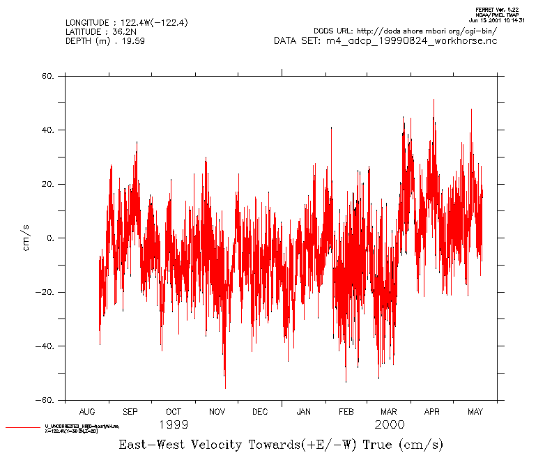
The hourly ADCP data sets have the data averaged in time to one hour intervals and interpolated to 5 meter bins. Below are the Ferret commands to load an orignal ADCP deployment data set and the corresponding hourly gridded data. The plot commands overlay the time series of the U component at 19.593 meters depth. The black lines are the original data and red lines are the gridded data.
use "http://dods.shore.mbari.org/cgi-bin/nph-nc/data/OASISdata/netcdf/hourlyM4.nc"
use "http://dods.shore.mbari.org/cgi-bin/nph-nc/data/OASISdata/deployments/m4/199908/m4/netcdf/m4_adcp_19990824_workhorse.nc"

plot/z=19.593 U_COMPONENT_UNCORRECTED
plot/z=19.593/ov U_UNCORRECTED_HR[d=1]
frame/file=timeAvg1.gif
Let's zoom into a 2-day period of this time series
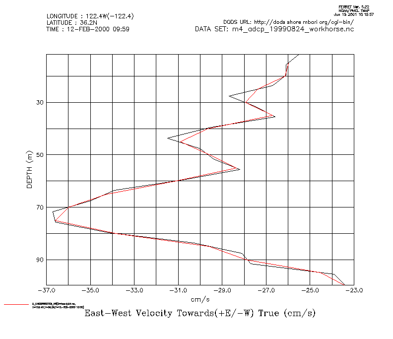
plot/z=19.593/t=12-feb-2000:14-feb-2000	U_COMPONENT_UNCORRECTED
plot/z=19.593/t=12-feb-2000:14-feb-2000/ov U_UNCORRECTED_HR[d=1]
frame/file=timeAvg2.gif
Let's look at a depth profile for 1000 12-feb-2000 GMT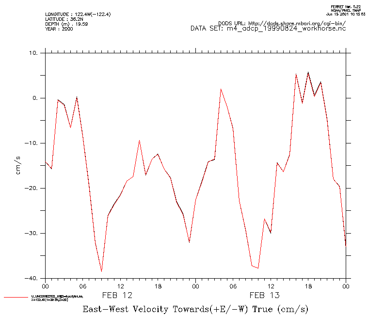
go graticule
plot/t="12-feb-2000 10:00"/z=0:100 U_COMPONENT_UNCORRECTED
plot/t="12-feb-2000 10:00"/z=0:100/ov	U_UNCORRECTED_HR[d=1]
frame/file=depthInt1.gif
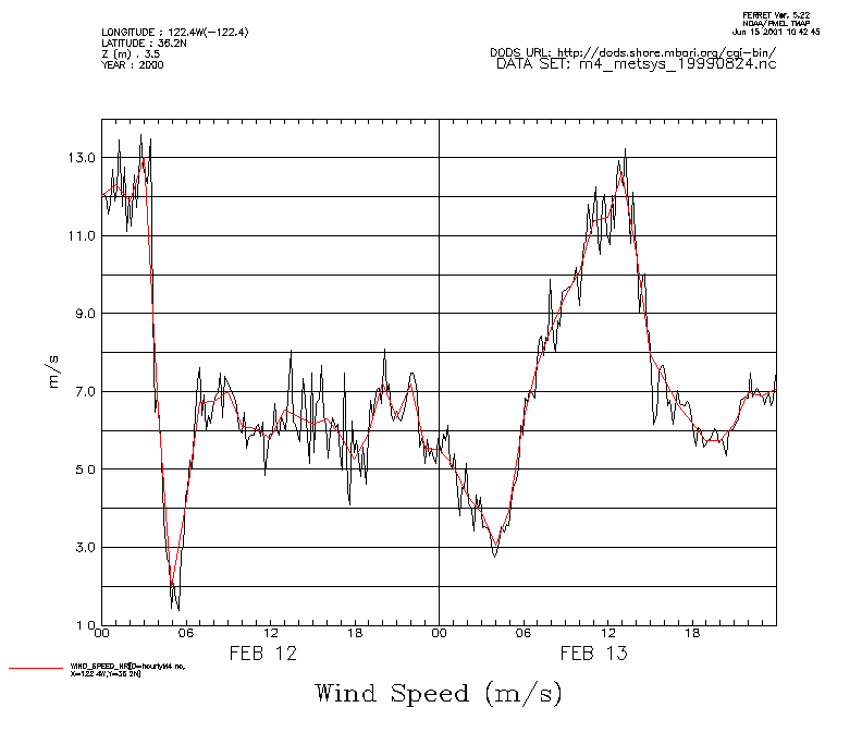
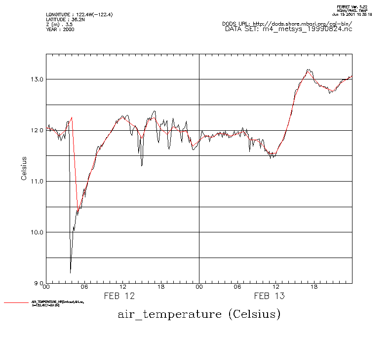
The effect of the hourly averaging is not evident for the ADCP data as the original data have a time interval of one hour. Let's load the original metsys data for this deployment and examine the averaging of air temperature and wind speed for the same 2 day period.
use "http://dods.shore.mbari.org/cgi-bin/nph-nc/data/OASISdata/deployments/m4/199908/m4/netcdf/m4_metsys_19990824.nc"
plot/t=12-feb-2000:14-feb-2000 AIR_TEMPERATURE
plot/t=12-feb-2000:14-feb-2000/ov AIR_TEMPERATURE_HR[d=1
frame/file=timeAvg3.gif
plot/t=12-feb-2000:14-feb-2000 WIND_SPEED
plot/t=12-feb-2000:14-feb-2000/ov WIND_SPEED_HR[d=1]
frame/file=timeAvg4.gif