Parent Directory
Parent Directory
Parent Directory
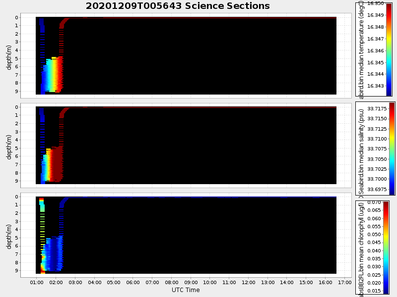
| Start time | End time | Last Latitude & Longitude |
Current (1hr avg) |
|---|---|---|---|
| 2020/12/09 00:56:53 GMT 2020/12/08 16:56:53 local |
2020/12/09 16:35:26 GMT 2020/12/09 08:35:26 local |
36.802681092372 -121.78797805862297 |
0.8009868272492822 Amp |
| Downloads: | ||||
| shore.nc shore.mat |
shore.kml shore.kmz |
shore.asc shore.dir |
shore.csv shore.log |
argos_24hr.kml argos_week.kml, argos_month.kml |
| Elapsed time since start: ... | Elapsed time since last valid data: ... |