Parent Directory
| Start time | End time | Last Latitude & Longitude | Current (1hr avg) |
|---|---|---|---|
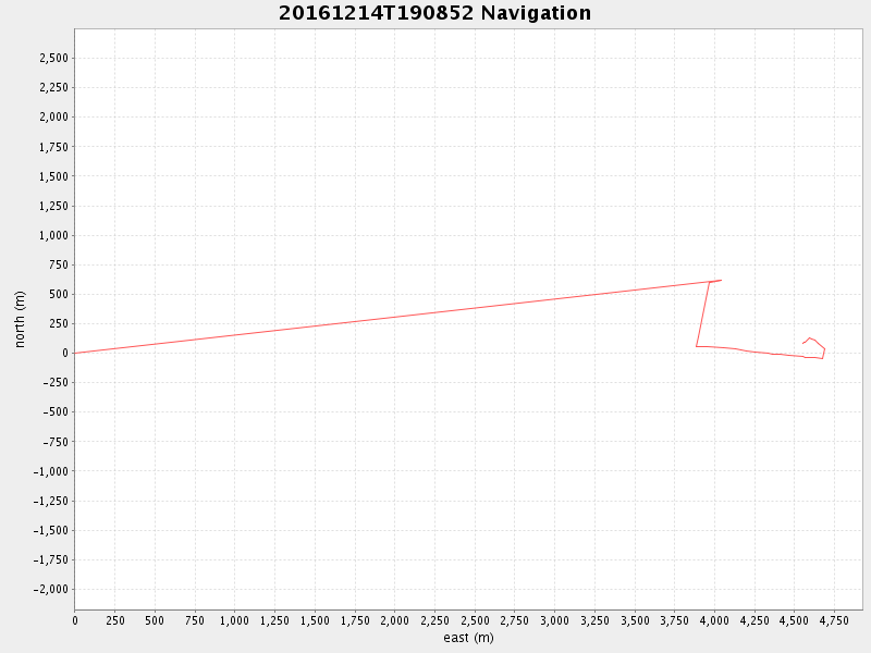
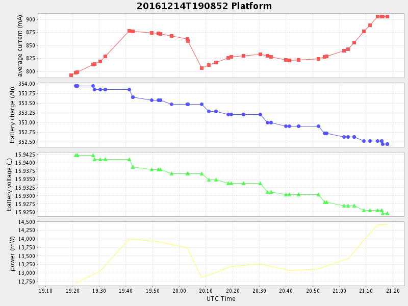
| 2016/12/14 19:13:22 GMT 2016/12/14 11:13:22 local | 2016/12/14 21:17:54 GMT 2016/12/14 13:17:54 local | 36.80276644347308 -121.77956886512001 | 0.7972964419450007 Amp |
| Downloads: | ||||
| shore.nc shore.mat |
shore.kml shore.kmz |
shore.asc shore.dir |
shore.csv shore.log |
argos_24hr.kml argos_week.kml, argos_month.kml |
| Elapsed time since start: ... | Elapsed time since last valid data: ... |