Parent Directory
| Start time | End time | Last Latitude & Longitude | Current (1hr avg) |
|---|---|---|---|
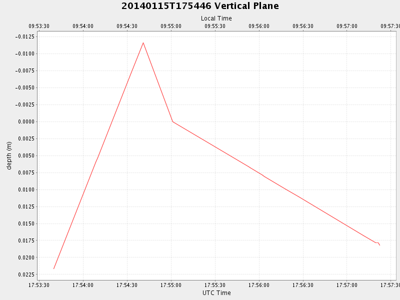
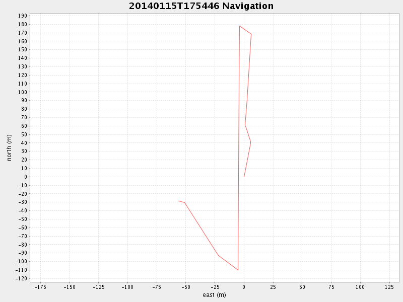
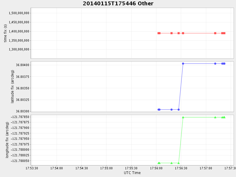
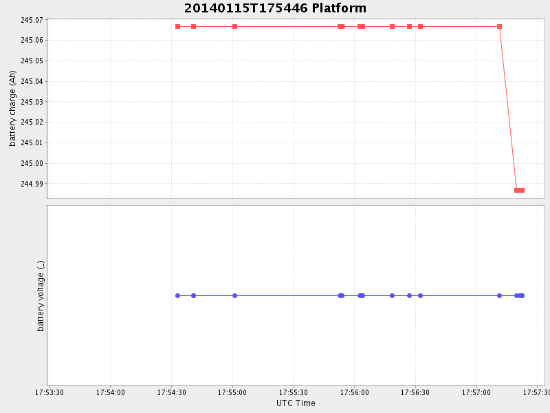
| 2014/01/15 17:53:39 GMT 2014/01/15 09:53:39 local | 2014/01/15 17:57:22 GMT 2014/01/15 09:57:22 local | 36.803773579128716 -121.78849016606321 | 1.6992184128253565 Amp |
| Downloads: | ||||
| shore.nc shore.mat |
shore.kml shore.kmz |
shore.asc shore.dir |
shore.csv shore.log |
argos_24hr.kml argos_week.kml, argos_month.kml |
| Elapsed time since start: ... | Elapsed time since last valid data: ... |