Parent Directory
Parent Directory
Parent Directory
| Start time | End time | Last Latitude & Longitude |
Current (1hr avg) |
|---|---|---|---|
| 2023/12/04 17:57:03 GMT 2023/12/04 09:57:03 local |
2023/12/04 19:27:05 GMT 2023/12/04 11:27:05 local |
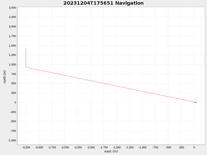
36.81544113138399 -121.82505798335573 |
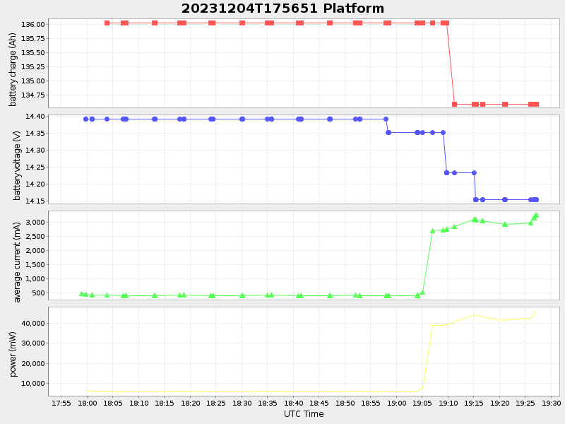
1.3706285627833656 Amp |
| Downloads: | ||||
| shore.nc shore.mat |
shore.kml shore.kmz |
shore.asc shore.dir |
shore.csv shore.log |
argos_24hr.kml argos_week.kml, argos_month.kml |
| Elapsed time since start: ... | Elapsed time since last valid data: ... |