Parent Directory
Parent Directory
Parent Directory
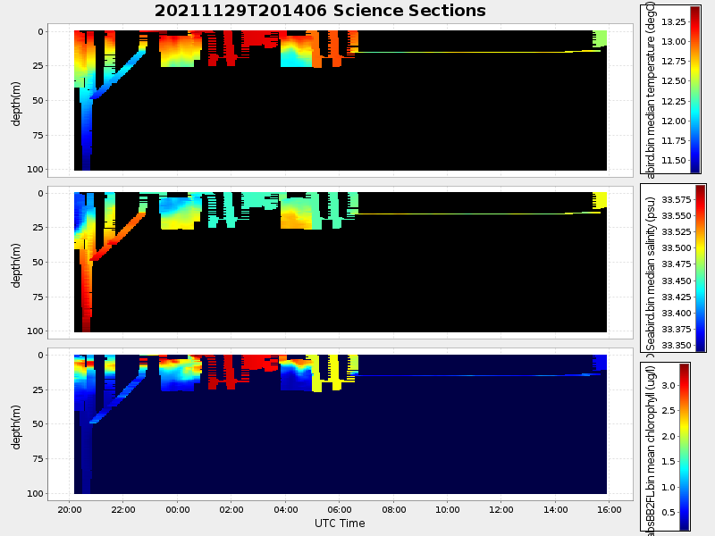
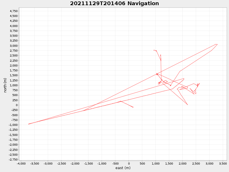
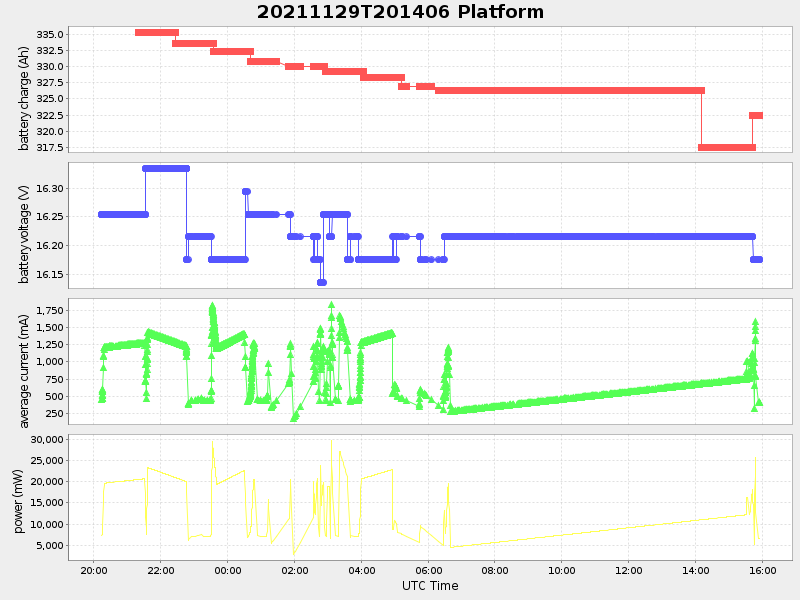
| Start time | End time | Last Latitude & Longitude |
Current (1hr avg) |
|---|---|---|---|
| 2021/11/29 20:14:17 GMT 2021/11/29 12:14:17 local |
2021/11/30 15:54:16 GMT 2021/11/30 07:54:16 local |
36.81993283328628 -121.83346066516711 |
-4.848290821184802 Amp |
| Downloads: | ||||
| shore.nc shore.mat |
shore.kml shore.kmz |
shore.asc shore.dir |
shore.csv shore.log |
argos_24hr.kml argos_week.kml, argos_month.kml |
| Elapsed time since start: ... | Elapsed time since last valid data: ... |