Parent Directory
Parent Directory
Parent Directory
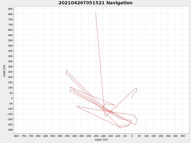
| Start time | End time | Last Latitude & Longitude |
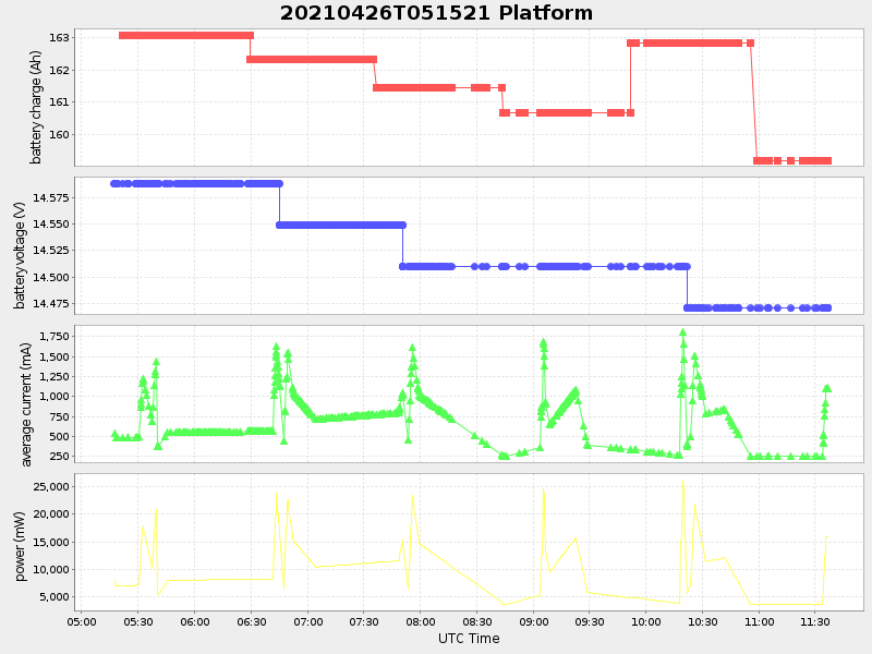
Current (1hr avg) |
|---|---|---|---|
| 2021/04/26 05:15:33 GMT 2021/04/25 22:15:33 local |
2021/04/26 11:36:28 GMT 2021/04/26 04:36:28 local |
36.805660999603084 -121.84837783333248 |
3.4402959525622725 Amp |
| Downloads: | ||||
| shore.nc shore.mat |
shore.kml shore.kmz |
shore.asc shore.dir |
shore.csv shore.log |
argos_24hr.kml argos_week.kml, argos_month.kml |
| Elapsed time since start: ... | Elapsed time since last valid data: ... |