Parent Directory
Parent Directory
Parent Directory
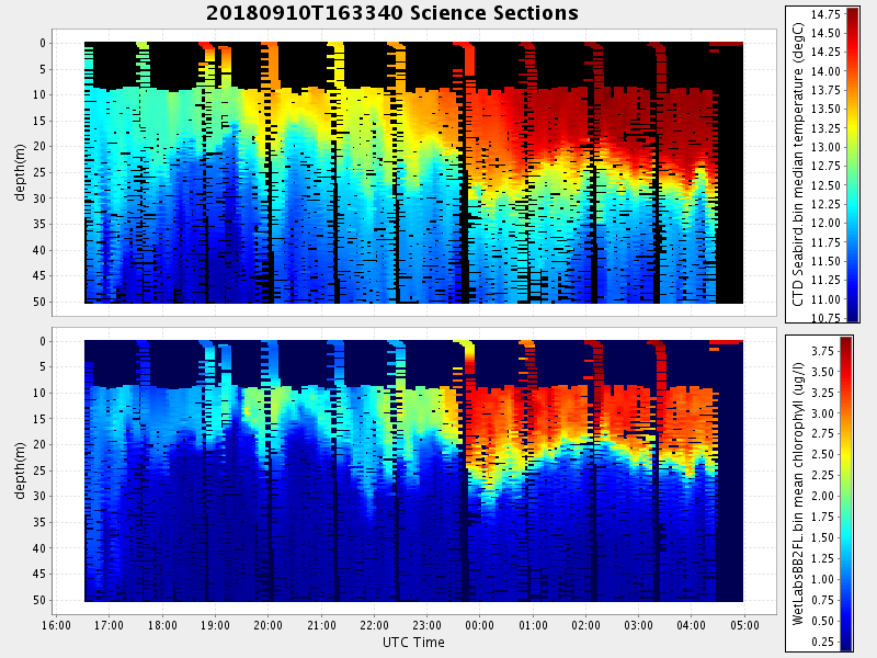
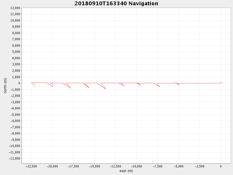
| Start time | End time | Last Latitude & Longitude |
Current (1hr avg) |
|---|---|---|---|
| 2018/09/10 16:33:41 GMT 2018/09/10 09:33:41 local |
2018/09/11 04:59:21 GMT 2018/09/10 21:59:21 local |
36.977867333316304 -122.4962051661332 |
3.2832930566826652 Amp |
| Downloads: | ||||
| shore.nc shore.mat |
shore.kml shore.kmz |
shore.asc shore.dir |
shore.csv shore.log |
argos_24hr.kml argos_week.kml, argos_month.kml |
| Elapsed time since start: ... | Elapsed time since last valid data: ... |