Parent Directory
| Start time | End time | Last Latitude & Longitude | Current (1hr avg) |
|---|---|---|---|
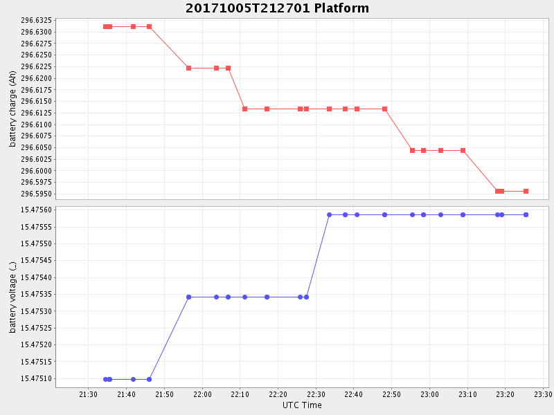
| 2017/10/05 21:27:20 GMT 2017/10/05 14:27:20 local | 2017/10/05 23:25:25 GMT 2017/10/05 16:25:25 local | 36.802991166451804 -121.78801749896336 | 0.015630246655565828 Amp |
| Downloads: | ||||
| shore.nc shore.mat |
shore.kml shore.kmz |
shore.asc shore.dir |
shore.csv shore.log |
argos_24hr.kml argos_week.kml, argos_month.kml |
| Elapsed time since start: ... | Elapsed time since last valid data: ... |