Parent Directory
| Start time | End time | Last Latitude & Longitude | Current (1hr avg) |
|---|---|---|---|
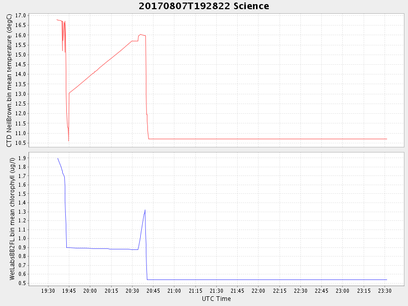
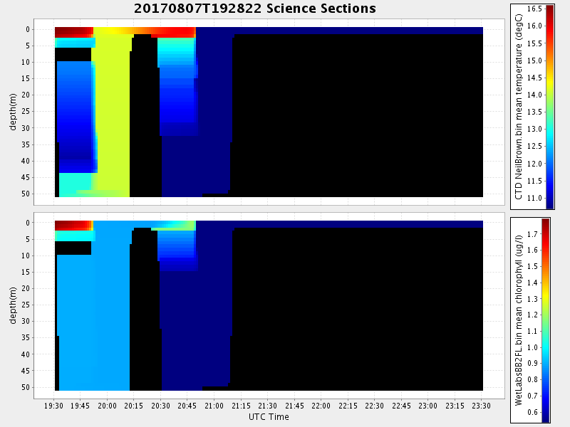
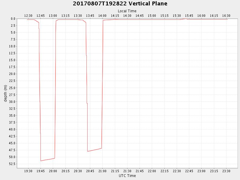
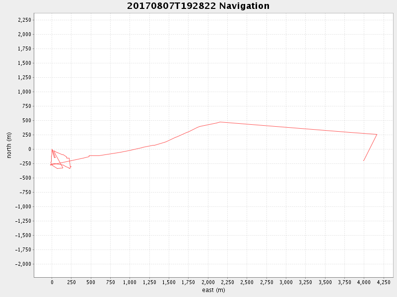
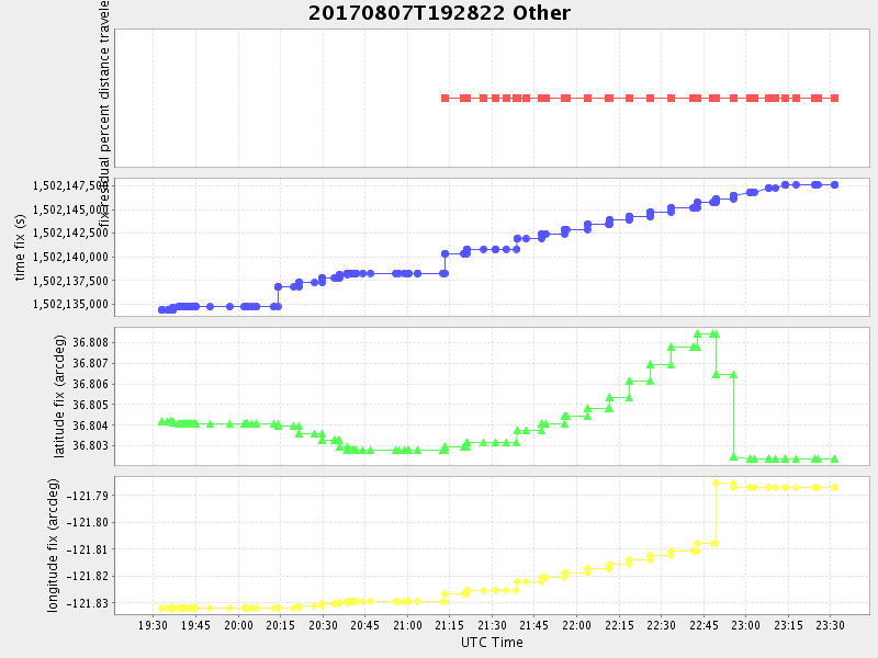
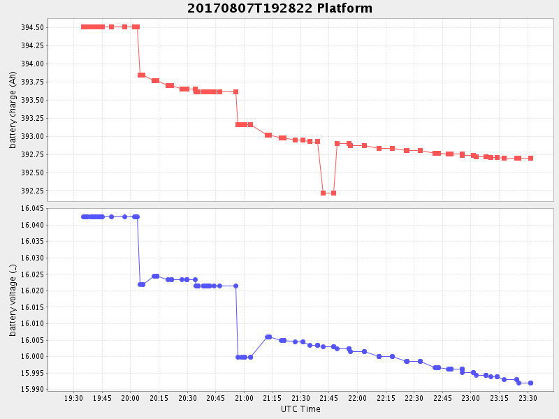
| 2017/08/07 19:28:33 GMT 2017/08/07 12:28:33 local | 2017/08/07 23:31:29 GMT 2017/08/07 16:31:29 local | 36.80236633295918 -121.78714083184369 | 0.09794947381791158 Amp |
| Downloads: | ||||
| shore.nc shore.mat |
shore.kml shore.kmz |
shore.asc shore.dir |
shore.csv shore.log |
argos_24hr.kml argos_week.kml, argos_month.kml |
| Elapsed time since start: ... | Elapsed time since last valid data: ... |