Parent Directory
| Start time | End time | Last Latitude & Longitude | Current (1hr avg) |
|---|---|---|---|
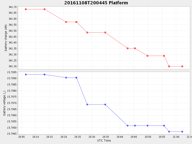
| 2016/11/08 20:06:32 GMT 2016/11/08 12:06:32 local | 2016/11/08 21:02:15 GMT 2016/11/08 13:02:15 local | 36.80288916634774 -121.78806833184585 | 0.5168642805500476 Amp |
| Downloads: | ||||
| shore.nc shore.mat |
shore.kml shore.kmz |
shore.asc shore.dir |
shore.csv shore.log |
argos_24hr.kml argos_week.kml, argos_month.kml |
| Elapsed time since start: ... | Elapsed time since last valid data: ... |